John Smith, Nieuw Engeland in twee scheeptogten door Kapitein Johan Smith inde iaren 1614 en 1615 be stevend. 1715. MC - 99 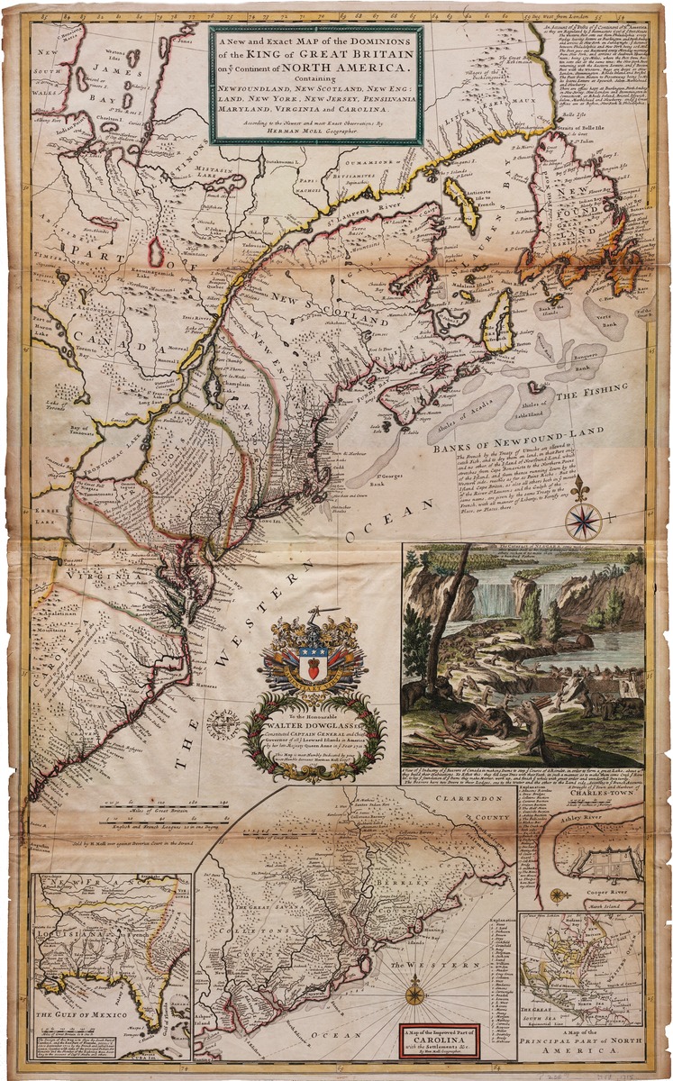
M. Rhein; Gottfried Rogg; Matthaus Seutter. Accurata delineatio celeberrimae Regionis Ludovicianne vel Gallice Louisiane ol. Canada et Florida adpellatione in Septemtrionali America descripta qui hodie nomine fluminis Mississippi vel St. Louis . . . 1720?. MC-22
Map of North America for Lord John Sommers. 1720. MCS-4 [Not digitized.]
Guillaume de L'Isle. Carte de la Louisiane et du Cours du Mississippi dressee sur un grand nombre de memoirs entr' autres sur ceux de Mr. le Maire par Guillaume de L'Isle de l'Academie Rle. des Sciences. 1730. MC-24
Herman Moll. A new map of north parts of North America claimed by France under the names of Louisiana, Mississippi, Canada and New France with the adjoining territories of England and Spain. ca. 1735. MC-33
Tobias Conrad Lotter. Recens edita totius Novi Belgii in America Septentrionali siti, delineatio cura et sumtibus Matthaei Seutteri... 1740. MC- 27
Herman Moll. A new and exact map of the Dominons of the King of Great Britain on ye continent of North America, containing Newfoundland, New Scotland, New England, New York, and New Jersey, Pennsylvania, Maryland, Virginia and Carolina. . . . by Herman Mol geographer. MC-86
Jean Baptiste Bourguignon. Amerique Septentrionale. Publiee sous les auspices de Monseigneur le Duc d'Orleans . . . . MCS-4
Georg Frederich Lotter; Guillaume de L'Isle, America Septentrionalis, concinnata juxta observationes Dnn Academiae Regalis Scientiarum et nonnullorum aliorum, et juxta annotationes recentisimas per G. de L'Isle . . . apud Tobiam Conr. Lotter . . . 1772. MC-25
Bowles's New Pocket Map of the United States of America; the British Possessions of Canada, Nova Scotia, and Newfoundland with the French and Spanish Territories of Louisiana and Florida . . . 1783. London. MC-109